Details

Friday, May 31, 2013

Ford to Glasgow via the Kintyre Peninsula and then to Portpatrick with a detour down memory lane.


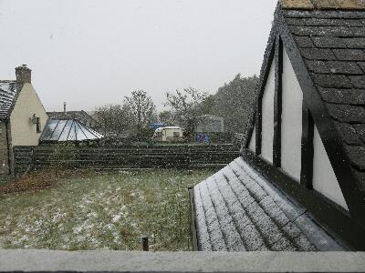
Apologies for the late posting of this and the next blog entry. Lack of time and lack of WiFi access prevented my usual prompt posting on a daily basis.

So - where were we? Ah yes south of Oban up a secondary road, deep in the hills and overnighting in the tiny hamlet of Ford. A delayed start to the day due to encountering a fellow Australian at breakfast. The consequent exchange of travel notes resulted in a prolonged breakfast and I only managed to get mobile shortly before 10am! Quelle Horreur!
As the day was fine and with Glasgow my ultimate destination I headed off southwards to Lochgilphead and the start of the Kintyre Peninsula. Lochgilphead and Ardishaig is one of the end points of the Crinan Canal. Built between 1794 and 1801, it is nine miles (14 km) long, and connects Loch Gilp with Jura Sound, providing a navigable route between the Clyde River and the Hebrides Islands.
Watched as a couple of yachts passed through the entrance lock before continuing south - heading for Campbelltown. Took the eastern route down the coast, a narrow B class road, rutted and full of pot holes. Slow going, but providing stunning views to the east of the island of Arran, its mountains capped by dark squally clouds trailing showers, the tail of one briefly peppering me with icy pellets of sleet. Despite the bad road, a good ride - albeit slow. And so to Campbelltown for lunch. A pretty port surrounded by lush green hills. After lunch, and aware of time and the distance still needed to cover to get to Glasgow, I headed back up the west coast of the peninsula - this time on the main (A grade) road. Light traffic and a good road allowed for rapid progress. However, the sudden darting of a deer across the road in front of me was a reminder that eternal vigilance is the price of safety (or some such words).
Skirting round Loch Fyne and Inverary the bad weather caught up with me and the traversal of Glen Kinglas and Glen Croe through the Arrochar mountains was suitably wet and gloomy. The rain eased to a drizzle as I passed down Loch Lomond, now on the A82, a major arterial road leading straight into the belly of the beast that is Glasgow.
I spent the night at my brother Scott's place. An excellent (cheap) curry at a local small family restaurant - and a glass of single malt at a local pub, followed by a long talk into the night. I hadn't seen Scott in 10 years - there was lots to talk about.


On the road by 8:30 am - heading south to Portpatrick on the south west corner of Scotland directly across  the Irish Sea from Belfast. Portpatrick is sometimes referred to by the locals as the 'Scottish Riviera', due to it's relatively (by Scottish standards) benign weather. The Port is where my aunt and uncle retired to, and an attractive village with a tiny harbor that was once (a long time ago) the stepping off point for travelers to Ireland.
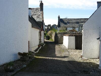
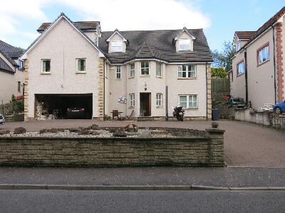
A detour from the direct route south to visit my childhood home of Dalry. Spent some time looking around the town. Lots has changed (road re-alignments and my old school demolished), but much remains unchanged. Including our old house and a large park in the centre of the town that I have strong memories of.

While wandering around the park, I ended up talking to a local who was out walking his dog. Turns out that David is a genealogist (http://www.rossgenealogy.co.uk/) and we had a pleasant discussion about origins and family trees.  
Nostalgia put aside, and following a route suggested by David I headed to the coast and avoiding the main road as much as possible discovered a couple of delightful small coastal villages - Dunure and Maidens.

Then back onto the main road at Girvan and so on to Stranraer and Portpatrick.

Tuesday, May 28, 2013

Bisecting Scotland from Northeast to Southwest. Brora to Ford (Oban)

A day for getting from A to B. In this case from Brora to Oban following the line of the Great Glen. 208 miles and 5 hours in the saddle. Apart from two periods of rain - the weather was better than expected. Given the constraints of time and weather I have had to bypass Skye and that part of the western coast. I'm spending the night in an out of the way spot called Ford, to the south east of Oban. The Ford Guest House is an old coach inn that has been revived as a cheap BnB. There are only a couple of nearby houses and farms but no pub, so a quiet night.
No mobile coverage and a fairly basic WiFi. Tomorrow I'll head for Glasgow via Inverary. If the weather is fine, may also explore to south, perhaps all the way down to Campbeltown at the bottom of the Kintyre Peninsula.
 

Monday, May 27, 2013

A North Eastern Loop

A most comfortable night. Shutters that keep out the twilight/dawn helped - as did the whisky!
A relaxed breakfast while doing yesterday's blog. Weather was overcast and cool but dry and no rain forecast.
Today's ride took me up the coast towards John O'Groats, avoiding the A9 main road to Thurso (the ferry point for Orkney), I took an inland route to visit the Grey Cairns of Camster. 5000 years old and amongst the oldest stone structures in Scotland. Although substantially restored by modern archaeologists, they retain an eerie authenticity, and one can only wonder what life was like for the people who built them. It is presumed that the climate back then was warmer than today.
On then to John O'Groats, for lunch amongst the tourists. Turns out that the famous sign post at John O'Groats is privately owned, belongs to a photographer who will charge you for the privilege of having your photo taken with it. He also takes the sign down at the end of the day because it keeps getting nicked!
In any case John O'Groats is NOT the most northerly point on the mainland. That title belongs to Dunnet Head - my next destination.
On a clear day - like today - Dunnet Head provides spectacular 360 views. The Orkney Isles can be seen to the north, and the northern coast stretches out in both directions. From John O'Groats in the east, all the way to Cape Wrath in the west. South lies the entire British Isles.
On to Thurso - the end of the A9 main road and the primary ferry point for the northern islands. A brief fuel stop then further east in the direction of Tongue. Passed the Dounreay Nuclear Power Station. Now in the process of being decommissioned. This is scheduled to be completed by 2036, but so-called 'Brownfield' status Will take another 300 years. That's right - 2336!
Shortly after passing Dounreay, I reluctantly turned off the main northern coastal road and headed back south through the so-called 'Flow Country'. Peat bog high moorlands - a unique habitat. The weather had improved through the afternoon and the road was quiet. Again - great riding. As the road dropped back down towards the coast, following a river, I was fortunate to spot a herd of dear on the hillside. Bonus points!
Back on the coast at Helmsdale and an early dinner. Fish and chips at the La Mirage Restaurant - ranked in the top 6 fish and chips shops in the UK. Sat at a table on the street, enjoying the warm afternoon sun and some mighty fine fish and chips, watching the locals come and collect their 'Fish Suppers'.
Back to Clyenish Farm and a quiet evening in front of the fire with a 'wee dram.' Another excellent day draws to an end. I wonder what the poor people are doing?

Sunday, May 26, 2013

Dingwall to Brora - The very scenic route

Doing this blog 'the morning after'. Too contentedly tired last night to think about anything other than sleep.
Yesterday was the perfect day's riding. Perfect weather, perfect scenery, perfect roads. 216 miles. 5 hours ride time.
From Dingwall I headed across to Ullapool on the west coast through forested glens, then north to Durness on the north west coast along a route that was stunningly beautiful. Blasted rugged glaciated mountains and valleys - traversed with a twisting undulating ribbon of bitumen - for the most part traffic free. The landscape becomes progressively treeless apart from the odd grove in some sheltered valley.
At one point as I cruised along, enjoying the conditions - I came up behind a slower vehicle. A tourist camper van. Checking my rear view mirror before overtaking I was astonished to see - coming up VERY fast behind me a line of 20 plus motorcycles. In short order the tourist van and I were passed at a great rate of knots. Later when I pulled into the cafe in Durness - packed with bikes - it turned out to be a BMW club run, led by an ex-motorcycle cop who clearly knew the roads and conditions.
After lunch and a quick look at Smoo Cave, I rode eastward along the north coast to the Kyle of Tongue. Yet more amazing scenery and roads. Passed one of Scotland more famous surfing spots, perfect conditions but only one lone (and I presume - cold) surfer. Lots of bikes in this area passing in both directions. At Tongue, left the coast and headed south inland and up into some high moorland country. Full of peat bogs, scattered with small lochs and a narrow single lane road with the occasional signposted 'passing place'. Big sky country, with views back across to the snowcapped peaks on the west. Again - despite the single lane road - great riding.
Finally dropped back down into Lairg and followed the glen down to the coast. A final 10 miles to my BnB. Clynelish Farm built by the Duke of Sutherland as a retreat alongside the local distillery. Only recently opened as a BnB by the delightful Victoria (ex Tamworth) and Jason her Scots farmer husband. Victoria's parents are visiting from OZ so the atmosphere was very relaxed and familiar. Only one other guest. After dinner in the village, a pleasant evening with the family discussing OZ and Scottish politics over the odd "wee dram". Collapsed into bed at 10:30 in a room with shutters and heavy curtains - no lingering twilight or early morning dawn. Bliss!

Saturday, May 25, 2013

Tomintoul to Dingwall - the scenic route.

It rained heavily overnight, but by breakfast it had eased to an intermittent drizzle. 8 degrees - positively balmy after the previous 36 hours of wintery conditions. The snow from the previous day still covered the higher ground and peaks, despite the rain. The forecast for the weekend is looking good!
The direct route from Tomintoul to Dingwall is only about 55 miles. So given the improved weather I punched into my GPS a route that would take me back inland and south along the River Spey, passing Aviemore and Kingussie on a minor road parallel to the main highway. Then along Loch Laggan to Spean Bridge where you enter the so called Great Glen leading back north to Inverness along a series of lochs culminating in Loch Ness. This is also where the Caledonian Canal is to be found. A series of locks and canals using the lochs to create a navigable route from the south west to the north east. A marvel of early 19 century engineering.
Lots of bikes on the roads today, most heading for the west coast. This weekend is Bank Holiday weekend, so lots of people heading for the hills. Lunch at 'The Thistle Stop' coffee shop at Aberchalder near Invergarry. A most excellent Plowmans Lunch washed down with the best coffee yet found in Scotland.
Turning North West at Urquart Castle, at the village of Drumnadrochit  (Love these Scottish names!) you leave the main road to Inverness, and climb out of the Great Glen taking the road to Beauly.
As it was only 2:30 when I got to Beauley, with only a couple of miles to my BnB for the night, I decided the weather was to good to waste, had a look at the map and found the village of  Cromarty at the end of a fat peninsula called the 'Black Isle' that sticks out into the North Sea. The name rang a bell - (It is an outstanding example of a 18th/19th century burgh 'the jewel in the crown of Scottish Vernacular Architecture' - apparently! ) and it was a perfect distance to burn up the rest of the afternoon. The Cromarty Firth (bay) is also where Invergordon is located. An important port used by the north sea oil rigs. The ride out to Cromarty was via a fantastic series of very minor roads - just watch out for the tractors crossing and the greasy cow muck on blind corners - avoiding the more direct route. Great way to end the days riding.
And so back to Dingwall and my host for this evening. Ian 'The Ancient Mariner' - a retired merchant sailor, who's been everywhere, seen everything and likes nothing better than to entertain an endless procession of foreign tourists who come and stay with him in his modest cottage overlooking the Cromarty Firth.
After a quick hello and cup of tea, I walk down the hill into Dingwall and the Mallard Pub for a pint and fish pie. Yum.
30 minute walk back up the hill and a final chat and nightcap with Ian then to blog to sleep to dream of ever winding roads that undulate through snow capped forest clad mountains that rise above shining lochs. Ah Scotland!

Friday, May 24, 2013

Tomintoul 'Rest Day'

The original plan had been to use Tomintoul as a base to explore the local area, which is why I had arranged to spend 2 nights at The Richmond Arms.
Well as the locals would say '"The best-laid schemes o' mice an' men gang aft agley."
When I awoke and ventured to look out the windows, snow flurries filled the air and a strong wind was punishing the trees.
It was cold enough that the snow had started to settle on the ground and the surrounding hills were white. It looked and felt more like mid winter than mid summer. Clearly not much riding would be done today.
At breakfast we were informed by our host that the high road (the road I had come in on yesterday) was closed to traffic due to snow and high winds, and on current forecasts was likely to remain closed for the next 24 hours. The 3 Irish bikers and the Aussie couple who were planning to head that way, were forced to change plans and head back down the only other road into Tomintoul.
I decided to sit back, relax and see what the day would bring. If by some miracle the weather improved I would take the bike out.
As forecasted though, other weather did not improve. Snow/sleet/cold rain came and went the whole day. Occasionally the sun would put in a brief dazzling appearance, before yet another squall passed through.
During one extended sunny break, around 1pm, I ventured out for a brisk walk. Although the sun was shinning, it was cold and the strong gusty wind made it even colder. Had lunch ( hot soup) in the local cafe and explored the whisky shop next door before retreating back to the hotel as yet another squally shower passed through.
I did notice on my brisk walk around the village that there were two other hotels in town - but both were shut and boarded up. Clearly the Tomintoul has seen better days.
Finished my book in the afternoon, surfed the net, checked and rechecked the weather reports. Hopefully tomorrow the weather will start to improve - it is forecasted to be cold but sunny over the weekend. But whatever it is, I will be back on the road.
A quiet dinner at the hotel. Joined by another couple - he German - she a kiwi. They had the Haggis. I opted for the pasta with mushroom sauce. Sampled some of the local whiskies - enjoyed stimulating after dinner conversation with my dining companions and the owners of the hotel. 10:30pm and time to write this blog and hit the sack. And so to bed.

Thursday, May 23, 2013

Scotland Day 2 - Cupar to Tomintoul

So awake by 6 am. Broad daylight already. Went for a walk around town looking for a likely shop where I could purchase a replacement power plug adaptor. Interesting to note that apart from newsagents and cafes that were already open, most places only opened 9/9:30 am. On the way back to the B and B for 7:30 arranged breakfast I discovered the local Tesco supermarket was already open - and it had a travel adaptor! To easy.
Breakfast (avoiding the 'full fry up' on offer), packed and on the road by 8:30. Beautiful weather - cool but sunny.
Punched in a scenic route to my destination on the GPS - Tomintoul- where I had booked accommodation in advance. I'd created routes before leaving OZ - that way I could enjoy the ride without having to read maps and navigate. The route I'd planned was inland towards Stirling before turning north on minor roads through Crieff, Comrie, along the east side of Loch Tay passing through Pitlochry and Braemar  - traversing 2 of the highest roads in Scotland.
Stunning scenery. Lush green pastures, forest, rivers in full pelt with the spring melt. Flowers on the roadside and fresh green growth on the trees. Mountains with snow and lochs in the valleys. Perfect riding weather until just north of Pitlochry. Then it turned foul. Squalls of sleet turning to snow in the high passes. Very strong winds. Temperature dropped from a balmy 14 degrees C to 3 degrees C. A warning light started to flash on the bike - it was the snow/ice warning!
Fortunately I had stopped and donned all my wet weather gear. Also the bike had heated grips - which helped. Still the last 10/15 miles into Tomintoul were a challenge.
Total distance: 178 miles
Total moving time: 5 hours 13minutes.
Tomintoul has the distinction of being the highest village in the Highlands. Making the pub - The Richmond Arms - the highest pub in the Highlands.
As I write this, the weather outside has cycled multiple times through sunshine, sleet, hail, rain, and snow. The forecast is looking bleak. Snow tonight, rain tomorrow. I've booked 2 nights here - with the idea of doing a days riding around the area tomorrow. We shall see. The forecasts change as frequently as the weather. Last night in Cupar, the forecast was looking good. This evening (it's now 7pm and the sun is still high in the sky) the forecast for the next few days is distinctly wintery. At least there are plenty of single malt Scotch varieties to sample while I wait for the weather to improve.
Meanwhile - somewhere in Serbia Celeste has met up with her good friend Katarina and from the photos she has sent is clearly having a good time. The food certainly looks better in Serbia than I have encountered so far in Scotland.

Wednesday, May 22, 2013

Scotland Day 1

Another day another country. Last night in Istanbul we had our worst hotel yet. We picked it because we wanted something close to the airport for our early departure times. Another 5am pickup. We asked the hotel for a 4:45 wake up call. They rang at 3:00am! Woops.

Celeste's flight to Belgrade left an hour before my flight to Edinburgh.
Flights on time and up to the usual Turkish Air standard. Managed an exit seat so plenty of room.

Cloudy when we landed, but I did get a good view of the Firth of Forth and both bridges. Countryside lush and green. It's been a wet spring so far.

Picked up at Edinburgh Airport by Dave from Cupar Motorcycles.
Had the bike (VStrom 650 - Marco will approve!) packed and was at my Cupar lodgings by 3pm.

Discovered that we had forgotten to transfer some documents, a book and a couple of CD's from my bag to Celeste's before we parted ways. Stuff she wanted to take to Israel. So off to the post office and 17 pounds + a padded bag later they were on their way to Jerusalem.

Also just discovered my adaptor plug for the UK DOES NOT WORK. So will have find one in Cupar tomorrow before I leave.

Early night tonight. 4am start plus extra 2 hours gained traveling west means its been a long day.